Representing the Earth
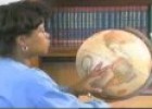
Globes and maps We use globes and maps to show what the Earth looks like. Globes show the Earth as a sphere. They show the true shape of the Earth and its tilt. They also show the positions of oceans and continents. Maps represent the Earth as a flat surface. They show the oceans and continents, but not the Earth's tilt. The first maps were not very accurate because in the past people did not know a lot about the Earth.
-
Idioma:
- Inglés
-
Formato:
Interactivo
Recurso educativo
Cursos y asignaturas
-
9 años:
- Biología
- Sociología
-
10 años:
- Biología
- Sociología
Tipo de recurso
- Interactivo
- Teoría
Uso del recurso
-
Aún no hay comentarios, ¡comparte tu opinión! Inicia sesión o Únete a Tiching para poder comentar
La licencia digital es una autorización que permite utilizar un recurso digital de acuerdo con las condiciones legales de dicho recurso. El código que recibas una vez la hayas comprado te permitirá acceder al recurso educativo digital elegido.
Puedes consultar más información en nuestra página de ayuda.






¿Dónde quieres compartirlo?
¿Quieres copiar el enlace?